


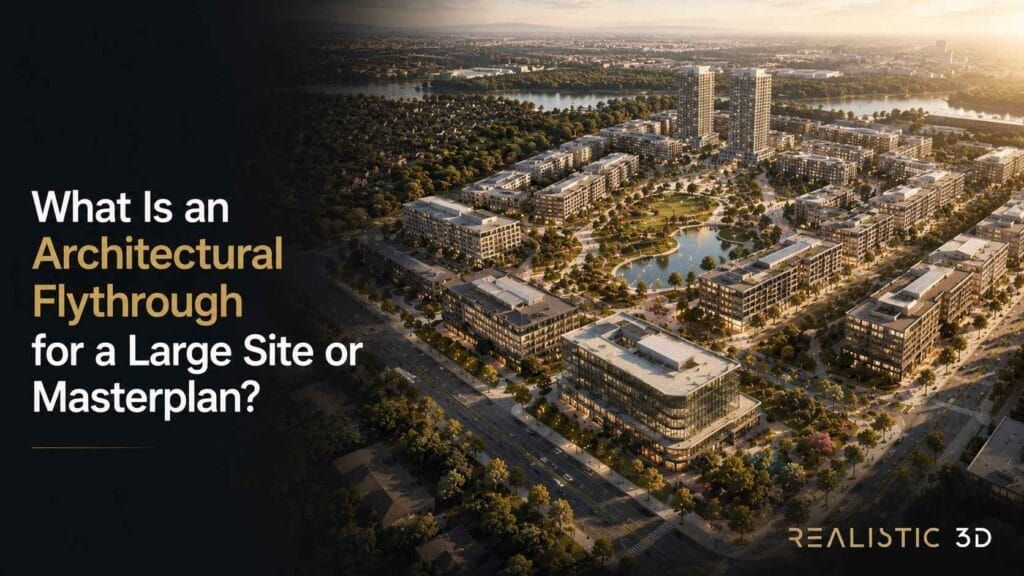
An architectural flythrough is a CGI film that moves above, around, and through a proposed development so people can understand where it sits, how its parts connect, and why the whole site matters. It is most useful when a masterplan, campus, precinct, or multi-building scheme cannot be understood from one image alone.
Picture a room full of people studying a polished masterplan. Everyone can see the buildings. Yet someone still asks where visitors arrive, which road carries them in, how the open space links the plots, or what sits beyond the site edge. That moment is familiar because a large scheme asks people to build a mental map from drawings, aerials, and disconnected views.
An architectural flythrough gives that map a sequence. It can introduce the district, locate the boundary, follow a meaningful approach, reveal a network of buildings and public spaces, then settle close enough to make the intended experience understandable. The result should feel less like a spectacle and more like a considerate guide who knows what a first-time visitor needs to see.
This is not a guide to turning every project into a movie. It is a guide to deciding what a site-scale film should explain, what it must label carefully, and how your team can make a useful visual asset from a complex development.
If you first need still images that establish the design, explore architectural 3D rendering. If motion is already part of the brief, 3D animation services can help shape the right format.
At a glance, an architectural flythrough should answer five practical questions. Where is the scheme, how do people reach it, how do its major parts relate, what is already there, and what is proposed. Everything else earns a place only when it helps one of those answers land clearly.
When does a large scheme need an architectural flythrough?
An architectural flythrough is most valuable when your audience needs to understand relationships across a site, not just the design quality of one building. A large-site architectural flythrough animation brings boundary, access, terrain, massing, landscape, and surrounding context into one guided view, so people can see how the development works as a place.
The format has a different job from a catalogue of rendered views. A still can establish a strong single idea. A site film can connect several ideas without making the viewer reconstruct the route in their own head. That matters when the scheme has more than one arrival point, several building types, a landscape network, a waterfront edge, a transit connection, or a relationship to existing streets that needs to be understood.
Which questions can a site-scale film answer?
A site-scale film can answer the questions that slow down a masterplan conversation. A property flythrough animation can show which parts belong together, how a visitor moves from the surrounding area to the main entrance, and why a particular building or public space sits where it does. It should not try to prove every technical outcome or replace the drawings that govern the project.
For a developer, the first question may be whether the site feels connected to the district. For an architect, it may be whether the landscape spine makes the parts of a campus read as one place. For an investor, it may be whether the relationship between a gateway, a core use, and later parcels is easy to grasp. The same film can support those conversations when it has a clear site question at its centre.
| Audience question | Visual evidence to include | Decision the film can support |
|---|---|---|
| Where is the development? | Site boundary, recognisable streets, water edge, transit link, or local landmark | Whether viewers can place the scheme in its wider setting |
| How do people arrive? | Main access route, pedestrian connection, gateway, drop-off, or arrival court | Whether the approach feels understandable and intentional |
| How large is it? | Building groups, open space, roads, planting, vehicles, and known context | Whether the scale and extent are easy to read |
| How do the uses connect? | Public realm, landscape corridors, shared facilities, and key thresholds | Whether the parts feel like a coherent place |
| What may change over time? | Clear existing, proposed, and future-phase treatment | Whether a viewer can separate current fact from future intent |
The table is a useful test for the brief. If your team cannot identify the question in the first column, the camera has no reason to travel through the answer in the second. The work may still look attractive, but it will be difficult to use in a serious project conversation.
When does an architectural flythrough beat a static aerial?
An architectural flythrough is more useful than a single aerial rendering when the point is the sequence between places. A still aerial can show overall layout very efficiently. An aerial flythrough can reveal the route from surrounding context to the site, the relationship between an arrival point and the wider plan, or the way a landscape corridor connects several building groups.
Use a still when the audience needs one approved overview for a report, board pack, sales panel, or project page. Use a film when the viewer must follow a connection and understand why it matters. A still may show a station beside a precinct. A flythrough can show the distance, the path, the intervening public realm, and the moment the development becomes visible from that path.
| If the audience needs to understand | Start with |
|---|---|
| One clear overview of layout and massing | Aerial rendering or masterplan image |
| Access, context, landscape, and building relationships as one sequence | Architectural flythrough |
| A guided visit at human scale inside a proposed space | Architectural walkthrough |
| Viewer-controlled exploration after orientation | Interactive 360 or virtual tour |
There is no need to force a film where a still does the job better. In fact, a strong flythrough often begins with a simple masterplan image because the still gives the viewer a stable reference before the viewpoint starts to move. That pairing makes both assets more useful.
When is a flythrough better than an architectural walkthrough?
A flythrough is better when the main question concerns the site, building form, access, external amenities, or connections between several places. A walkthrough is better when people need to experience a chosen route through a building at normal viewing height. The two formats can sit together, but they should not be asked to do the same work.
For example, a large residential precinct may need a site film to explain the park, road network, shared facilities, and relationship to nearby services. A separate interior-focused route can later help someone understand a particular unit or lobby. If interaction is the next requirement rather than a guided route, consider VR and AR visualisation or a Matterport 360 virtual tour.
Keep the choice simple. Use the format that answers the largest unanswered question first. A film that begins above a whole precinct and immediately dives into a kitchen makes two different promises in one breath. It is usually clearer to let the site story stand on its own.
Which schemes benefit most from an architectural flythrough?
An architectural flythrough works especially well where the value of the project lives between buildings as much as within one building. A building flythrough animation can make a campus, logistics park, sports complex, medical precinct, destination resort, data-centre park, mixed-use district, or civic scheme easier to understand because it shows the connections that plans often flatten.
Mixed-use masterplans benefit when retail, workspaces, homes, hospitality, and public spaces need to read as a connected everyday environment. Education campuses benefit when a visitor needs to see how arrival, learning spaces, sports fields, gathering areas, and landscape fit together. Industrial and logistics developments benefit when the site edge, main access, building placement, and scale need a calm visual explanation without turning the film into an operational simulation.
A property flythrough animation can also be useful for a large single asset. A resort, hospital, museum, stadium, warehouse, or headquarters may have one primary building but still require a wide view to explain its approach, setting, external amenities, or relationship to a larger estate. The size of the building matters less than the number of site relationships a viewer must hold in mind.
Before choosing the format, ask one friendly but demanding question. Could a person who has never seen the site point out the entrance, the main destination, and the most important connection after watching once? If the answer is no, a site-scale flythrough may be the missing piece.
What should a masterplan flythrough show from context to arrival?
A useful masterplan flythrough should move from a clear location anchor to the few relationships that make the development intelligible. It should establish the setting, identify the site edge, show how people enter, reveal the organising landscape or public realm, and then explain the building groups that matter most. It should not race over every parcel just because the model contains it.
The aim is site legibility. A viewer should leave with a simple mental map that survives after the screen goes dark. They need to know what they are looking at, where it sits, how it is reached, and what the design is asking them to notice. The route can be cinematic, but each move still needs an informational purpose.
What should viewers know after the opening 15 seconds?
The opening should tell a first-time viewer where the project sits and what relationship the film will explain. A reliable architectural flythrough animation usually begins with one recognisable anchor, then gives the viewer a stable view of the development boundary before it moves closer.
An anchor can be a major road, a water edge, a transit connection, a known public facility, a ridge, a gateway, or a visible neighbouring district. The right choice depends on the project. A remote resort may need its coastline and approach road. A city campus may need a station, arterial street, or public square. A business park may need its highway connection and access point.
The first seconds can do four small but important jobs.
- Identify the wider setting without pretending the whole region needs to be shown.
- Make the site edge or project extent legible.
- Indicate the main arrival route or point of connection.
- Signal the central idea the viewer should follow next.
This does not require a busy map overlay. A quiet location label, a short top-down pause, or a gentle shift from district to site can be enough. The test is simple. If the camera suddenly reaches the proposed buildings and the viewer has no idea how it got there, the opening has skipped the context that makes the reveal meaningful.
Which site relationships deserve a place in the route?
The route should show the relationships that make the scheme work as a site. Those usually include access, building groups, public realm, landscape, key thresholds, visible context, and a defining shared amenity. The order should reflect the question your audience needs answered, not the order in which the model was built.
| Site relationship | Useful visual move | What the viewer should understand |
|---|---|---|
| Boundary and setting | High, stable overview with visible context | Where the project begins and what it relates to |
| Arrival and access | Movement along a real road, path, water approach, or transit connection | How a visitor reaches the scheme |
| Building groups | Gradual reveal across massing and open space | Which uses form a cluster and how they relate |
| Public realm and landscape | Travel along a green spine, plaza, promenade, or courtyard network | What links the development beyond roads |
| Key destination | Descend or slow near a gateway, central amenity, or landmark building | Where the main experience concentrates |
| Future parcel or phase | Wide view with clear status label | How later intent fits within the larger plan |
Notice what does not appear in the table. There is no instruction to show every façade, every rooftop, or every plot at the same speed. Equal attention can make a large site harder to read. A good route gives important relationships room to register and lets secondary context remain secondary.
It also helps to choose one organising thread. On a waterfront development, that may be the promenade. On a campus, it may be the pedestrian spine. On an industrial precinct, it may be the arrival road and central circulation loop. On a mixed-use district, it may be the public square that connects different uses. The thread gives the viewer something to follow while the scheme becomes more detailed.
How should existing, proposed, and future elements be separated?
Existing, proposed, and future elements should be visibly different so a viewer never has to guess what is confirmed, what is current design intent, and what remains indicative. A flythrough is persuasive only when its visual clarity is matched by clear status.
Start with a short status vocabulary that everyone on the project agrees to use. Existing context can be shown as current verified information. Proposed development can be shown as the current design. Later phases can be labelled as future or indicative where that is the honest description. Approximate context, such as generic neighbouring massing or landscape that is not part of the project, should not be allowed to look like a fixed commitment.
Colour can help, but colour alone is not enough. Use labels, a small legend, scene notes, or a deliberate shift in treatment as well. A future parcel might have a lighter massing treatment and a plain future-phase label. A representative streetscape may be softened with a nearby note that it is illustrative. The viewer should not need specialist knowledge to detect the distinction.
This is especially important when local planning, permitting, entitlement, or marketing rules are involved. Requirements differ across markets and project stages. The project team should agree the wording that is appropriate for its own approvals and disclosures before the visual is shared publicly. The film can make the plan easier to understand, but it must not turn a working concept into a promise by accident.
How can terrain and context data strengthen the site story?
Terrain and context data strengthen a masterplan film when they explain real site relationships, such as slope, water, road level, existing buildings, or a long approach. An overhead site sequence needs that spatial foundation because a wrong level, missing ridge, or invented adjacent street can make a plausible image tell the wrong story.
Large-site CGI often brings together survey information, a design model, topography, mapping, public elevation data, aerial reference, and context models. The Open Geospatial Consortium 3D Tiles standard describes a technical ecosystem that can handle large geospatial content such as photogrammetry, 3D buildings, BIM and CAD, and point clouds. The practical lesson is less about a file format and more about discipline. Every source needs a known date, origin, level of confidence, and owner.
Public terrain sources can provide useful early context, but they do not replace a current project survey or the approved design information. The USGS 3D Elevation Program is one useful reference in the United States. Geoscience Australia digital elevation data shows the same need to check coverage, resolution, capture date, and custodian in Australia. Similar checks apply wherever your project is based.
Mapping also has rights and attribution requirements. If a base map or road network uses OpenStreetMap data, read the OpenStreetMap copyright and attribution guidance before publishing. Source rights may feel separate from visual quality, but they are part of making a site story safe to use.
For your brief, record four details beside every context source. State where it came from, when it was captured or issued, what it is reliable enough to show, and what it must not be used to imply. That small ledger keeps the visual team from treating a convenient reference as a verified fact.
When should the film use a map moment or on-screen label?
Use a map moment or label whenever the viewer would otherwise need to work out location, direction, status, or scale alone. A label should reduce effort, not decorate the frame. The best labels are brief, placed near the thing they identify, and timed to the moment a viewer needs them.
An opening label can identify the project and broad area. A discreet line or marker can make a pedestrian connection clear. A phase label can stop a future parcel from being mistaken for a current commitment. A simple north cue can help when the film makes a large turn around a site. These are not graphic extras. They are orientation tools.
Avoid covering a detailed view with a presentation slide. Let the camera carry most of the explanation, then use text only where a viewer could draw the wrong conclusion without it. If a route needs a paragraph of labels to make sense, the route may be trying to answer too many questions.
How can aerial camera moves make a large scheme easier to read?
A clear site-scale flythrough uses camera height, direction, pace, and lens choice to reveal one relationship at a time. It starts high enough to orient the viewer, lowers only when a closer view adds understanding, and returns to a wider view when the viewer needs to reconnect that moment to the whole scheme.
The camera is not just a moving viewpoint. It controls the evidence the viewer receives. At site scale, a small change in altitude can reveal a road connection, hide a site boundary, flatten a change in terrain, or make two buildings look farther apart than they are. That is why camera decisions deserve the same care as the masterplan image itself.
Why should the camera begin with an orientation anchor?
An orientation anchor gives a viewer a reference they can keep while the aerial flythrough begins to move. Without it, a beautiful opening pass can become a memory test. The viewer may enjoy the scene yet still be unable to say which side of the project faces the main road or where the key entrance sits.
Choose an anchor that survives the move. It might be a road junction, shoreline, rail corridor, park, stadium, bridge, gateway, or neighbouring building cluster. Hold it long enough for the eye to register it, then travel toward the site along a relationship that makes sense. A slow approach from a known road is more helpful than an instant teleport above a roof.
The anchor also gives the editor a useful reset point. When a film later moves closer to a destination, a brief return to the wider relationship can remind the viewer how that moment fits within the masterplan. This is not repetition. It is what makes a complex site feel navigable.
How should altitude change across an aerial flythrough?
Altitude should change when a new camera height answers a new site question. A high view explains setting and extent. A middle view explains access, building groups, and landscape. A closer view explains a gateway, outdoor destination, or threshold. An aerial flythrough becomes easier to read when each descent has a reason.
| Camera band | Best question to answer | Useful move | Common mistake | | — | — | — | | High site overview | Where is the scheme and how large is it? | Stable view that shows boundary and wider context | Starting so high that the project becomes a tiny diagram | | Mid-level connection view | How do roads, landscape, and buildings relate? | Follow the approach or public-realm spine | Moving too fast for the route to register | | Low external destination view | What happens at the main arrival or shared place? | Slow beside a gateway, plaza, promenade, or forecourt | Treating every scene as a dramatic low pass | | Return overview | How does this moment fit back into the whole? | Rise or pull back to reconnect the scene | Ending on a close detail without restoring scale |
For a building flythrough animation, altitude is also a way to control apparent density. A high view may make a campus look compact, while a lower oblique view can reveal the walking distances, changes in level, and landscape separation that are invisible from above. Neither view is more truthful by itself. The film becomes more truthful when it shows both at the point each matters.
Do not use height only to create a big reveal. A camera that repeatedly drops from the sky can feel impressive for a few seconds, then leave the viewer with no stable sense of direction. The best transitions preserve a connection the viewer already understands.
What does lens choice change in a building flythrough animation?
Lens choice changes how much of the site fits into the frame and how relationships appear to stretch or compress. A building flythrough animation needs a lens that keeps the relevant relationship legible without making roads, building separation, or terrain feel distorted.
Very wide views can help establish context, but they can exaggerate foreground scale and bend verticals near the frame edge. A longer lens can make distant elements feel closer together, which may be useful for an external landmark but can hide the separation between building groups. A moderate view often gives the clearest sense of ordinary spatial proportion when the camera is moving through a masterplan.
There is no universal number that suits every project. The right choice depends on the site, the desired context radius, and the relationship being explained. What matters is consistency. If one sequence makes a boulevard look broad and open, then the next makes it look narrow through an extreme lens, the viewer may notice the contradiction even if they cannot name it.
Use a simple review question. Does the view help a person judge where things are in relation to each other, or does it make the scene feel exciting at the cost of scale? For a project presentation, clarity normally earns more trust than a clever distortion.
When should a camera descend to a closer site moment?
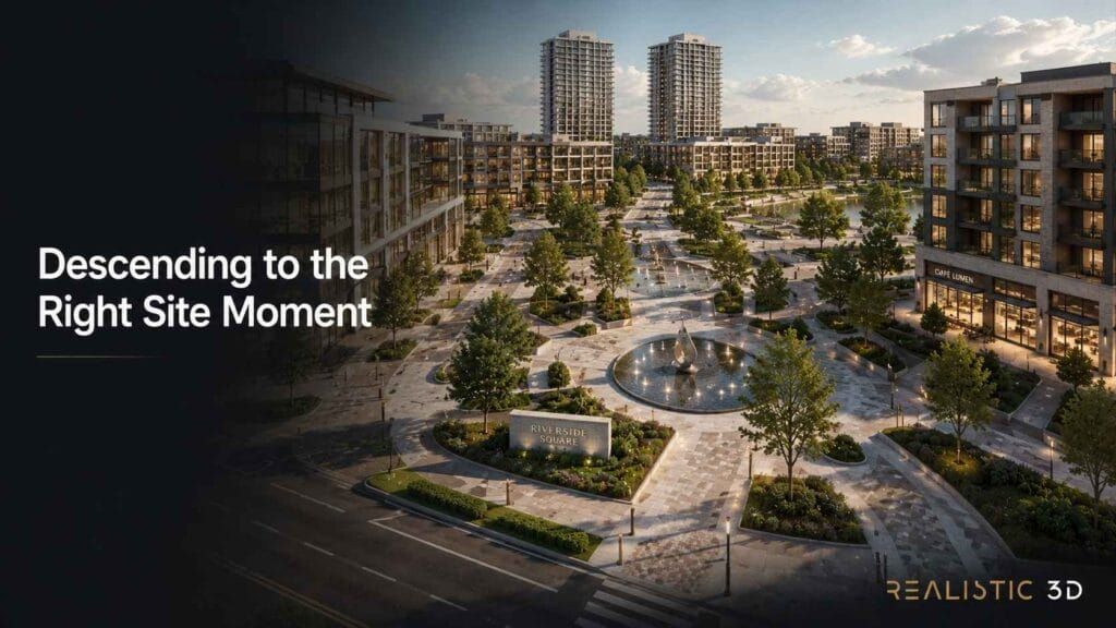
The camera should descend when a closer view reveals the value of a site relationship that the wide view introduced. In an architectural flythrough animation, that might mean moving from the whole park network to the arrival at a central pavilion, from the district road to the project gateway, or from a campus overview to the public space that links its major buildings.
The close moment should remain external and connected to the site story. It can show a drop-off, plaza, waterfront walk, landscaped courtyard, pedestrian bridge, façade entry, or shared amenity. The moment has a clear place on the mental map because the viewer has already seen it from above.
Do not descend only because every film needs a close-up. If the whole purpose is to explain a large distribution site, a low pass beside one wall may add little. If the purpose is to show how a public square connects several uses, slowing near that square may be the most valuable part of the film. The camera earns detail by answering a larger question first.
Is a drone-style flythrough the same as drone footage?
A drone-style flythrough is CGI designed to feel like a controlled aerial journey. It is not real drone footage, a record of an actual flight, or evidence that a particular camera position can be flown or permitted. It should be presented as a designed visual representation of the project.
That distinction protects both credibility and planning. CGI gives a team freedom to move through a proposed building group, travel along a future public path, or reveal a scheme from a height that would not suit an actual drone. It should not use that freedom to imply that existing conditions, visibility, permits, or future access are guaranteed.
If real footage is part of the campaign, treat it as a separate source with its own location, date, permissions, and local aviation requirements. The CGI sequence can complement it, but the two should not blur together in a way that confuses a viewer about what exists today.
How should movement and landscape support the site story?
Movement and landscape should help a viewer read scale, season, use, and connection without claiming a fixed future outcome. A property flythrough animation can use people, vehicles, water, planting, and light to make a large site feel inhabited, but those elements should support the project story rather than compete with it.
Use people as scale references around a public space, gateway, or pedestrian spine. Use vehicles to show a road has a role in arrival, not to model traffic performance. Use planting to define the intended landscape structure, not to conceal unresolved edges or erase neighbouring conditions. A calm level of activity usually makes the site easier to interpret than a busy scene filled with unrelated motion.
Time of day matters for the same reason. Morning light may clarify an eastern arrival. Late afternoon may support a waterfront or public-realm scene. Choose light that exposes the relationship you want the viewer to see. Heavy shadow can make a sculptural image, but it can also hide paths, gradients, entries, and building separation that the film is supposed to explain.
How should a team scope a flythrough that stays honest and useful?
Scope an architectural flythrough by agreeing the audience, site question, visible extent, current design status, and source confidence before choosing runtime or visual style. That keeps the film focused on what the scheme needs to communicate and stops a large masterplan from becoming an expensive tour of every object in the model.
The most useful brief is not necessarily long. It gives the visual team a reliable boundary around the work. It says which places must be shown, which context needs verification, what is proposed, what can remain representative, and what a viewer should understand after watching. Those decisions are far more valuable than a vague instruction to make the project feel impressive.
What must be ready to scope a large-site film?
A large-site film needs a current masterplan, site boundary, design information, terrain or survey reference, surrounding context, access priorities, and a clear statement of project status. A strong architectural flythrough animation starts with these spatial facts because they determine what the camera can show honestly.
| Brief item | Why it matters at site scale |
|---|---|
| Current masterplan and boundary | Defines the extent of the development and prevents the route from drifting into unapproved areas |
| Survey, terrain, and levels | Keeps roads, water, slope, and building placement credible |
| Current massing or design model | Shows the level of certainty in building form and external spaces |
| Context information | Identifies streets, landmarks, adjacent buildings, vegetation, and visible edges that affect orientation |
| Access and movement priorities | Gives the film a real path through the site rather than a random orbit |
| Existing, proposed, and future status | Helps viewers distinguish current fact from design intent |
| Primary audience and decision | Changes whether the route prioritises investment, project review, public understanding, or launch communication |
| Delivery setting | Identifies whether the film will be shown in a presentation, on a project page, in a consultation, or in a campaign |
It helps to include one simple plan markup with the intended camera route and the questions attached to each stop. Not a lengthy production script. Just a shared visual note that says why the film begins at this road, pauses at this gateway, rises above this landscape spine, and finishes at this building group. That note often reveals when two stakeholders are asking the same film to tell incompatible stories.
For a complex scheme, name a single source owner for each category of information. The design team may own current massing. The landscape team may own planting intent. A survey source may own topography. The developer may own the approved communication language. Clear ownership helps the flythrough remain useful when the masterplan changes.
How should a team show changing masterplan status?
A team should define accuracy by separating verified site facts, current design intent, representative context, and future or illustrative elements. That approach lets a flythrough remain helpful even when a masterplan is evolving, because the viewer can see what each element is meant to represent.
A practical way to do this is to keep a short confidence ledger alongside the visual brief.
| Element type | Working rule for the visual |
|---|---|
| Verified existing condition | Match the current approved or surveyed source as closely as the agreed visual purpose requires |
| Current proposed design | Show the latest issued intent and identify it as proposed where the audience needs that context |
| Representative surrounding context | Use it for orientation and scale, not as a claim about a third-party future outcome |
| Future phase | Make its status visible through labels, treatment, and supporting page text |
| Unresolved option | Leave it out or state that it is an option rather than presenting it as a settled result |
This is not a substitute for planning documents, approvals, contracts, or local professional advice. It is an editorial discipline for visual communication. When everyone can see the confidence level of each part of the scene, the team can update the film without rewriting its meaning every time a parcel changes.
It also makes conversations friendlier. Instead of arguing about whether a rendered context looks final enough, the team can ask a more useful question. Is this element being used as verified fact, current intent, or representative background? Once that is clear, the right visual treatment usually follows.
Which factors shape cost and delivery time at site scale?
Cost and delivery time are shaped mainly by the amount of site information that must be made legible and the number of final versions your audience needs. For a site-scale film, a large context radius, detailed terrain, many building groups, roads, landscape, moving elements, design changes, and multiple stakeholder versions usually have more impact than runtime alone.
The right scope starts with the smallest useful route. You may only need the district connection, the primary arrival, the central public realm, and one key destination. Adding every future parcel, every secondary road, and every façade detail may increase effort without giving the viewer another useful answer.
This type of site film also becomes more complex when source material conflicts. A current survey, a conceptual landscape plan, an older aerial reference, and a new massing model may all describe the site differently. Reconciling those differences is part of the work because the final film will bring them together in one view.
Ask for a scope that names the visible area, number of key scenes, status of context, expected design maturity, and the intended versions. That creates a more meaningful estimate than asking for a general minute of animation. For the broader principles behind motion visualisation, the Realistic 3D video gallery is useful for discussing finished film types, and the project portfolio can help your team review relevant site-scale examples.
How can one site film serve each stakeholder?
One site film can serve different stakeholders when all versions share the same verified spatial story and each version changes only the emphasis. A well-planned site film may give project leadership the whole site logic, give investors the value of connection and scale, and give a public-facing audience a clear introduction to the place.
| Audience | Main question | Useful version |
|---|---|---|
| Project leadership | Does the scheme read as a coherent site? | Full context-to-destination sequence with status notes |
| Investor or partner | Why does location and connection support the proposition? | Concise sequence that foregrounds access, scale, and major destinations |
| Approving stakeholder or consultation audience | What is proposed and how does it relate to its surroundings? | Clear context, labels, and restrained future-phase treatment |
| Future occupier or visitor | Where is the site and how do I reach the important places? | Simple arrival-focused version with the essential wayfinding cues |
| Project website visitor | What is this development in one quick view? | Short opening sequence with a link to the full project information |
The master story should not change its facts between versions. A property flythrough animation can be shortened for a project page and still retain the location, arrival, and status cues that make it honest. It should not quietly change the boundary, status of a future phase, or relationship to an existing landmark. Reuse works when the shared visual truth remains intact.
Keep a full-resolution master and a documented list of approved scene labels, but do not confuse that with a general delivery checklist. At site scale, the asset that matters most is the maintained spatial reference. It lets the team return to a known route when the project needs an updated scene months later.
What should a flythrough page include?
A flythrough page should include a concise written summary of the site story, accurate captions when the film has narration or meaningful audio, and page metadata that describes the visible video. This makes the project easier to understand for people who do not watch immediately and gives search systems useful context around the embedded film.
The W3C guidance on captions and subtitles is a good reference for caption quality. For search implementation, follow Google guidance for VideoObject structured data only when the video is actually visible on the page and the markup matches what a visitor can see. Do not add video markup to a page that has no accessible film or to a generic service page that does not present that specific asset.
Keep the accompanying copy practical. Identify the site, explain the primary connection or arrival sequence, state the design status, and link to the fuller project information. Avoid empty phrases about an immersive experience. Search readers and human readers both benefit from a plain explanation of what the film helps them understand.
If you want an experienced visualisation partner to review the site question before a film is commissioned, learn more about Realistic 3D or contact the team. The most valuable first discussion is usually about the places people struggle to understand, not a list of camera tricks.
What else do teams ask about architectural flythroughs?
What is an architectural flythrough?
An architectural flythrough is a CGI film that moves around and above a proposed site or building. It helps people understand context, access, scale, building relationships, and important external spaces before the project is complete.
When should a developer use a flythrough for a masterplan?
Use an architectural flythrough when a masterplan has connections that a single aerial image cannot explain. It is especially useful for multi-building sites, complex arrival routes, landscape networks, phased development, and locations where surrounding context affects the decision.
How is a flythrough different from an architectural walkthrough?
A flythrough explains a site, building form, or external relationship from above and around the project. A walkthrough usually follows a human-scale route through a building. Use the format that answers the audience question first.
Can an aerial flythrough show a whole development site?
Yes. An aerial flythrough can show the wider setting, boundary, access, building groups, landscape, and key destinations in one sequence. It should still label proposed and future elements so viewers can separate current conditions from design intent.
Is a drone-style flythrough real drone footage?
No. A drone-style flythrough is a CGI camera route designed to create an aerial perspective. It should not be presented as footage of an actual flight or as evidence of permits, existing views, or future access.
What files are needed for a building flythrough animation?
A building flythrough animation needs a current site plan, design model or massing, boundary, terrain reference, access priorities, and available context information. The team also needs clear guidance on what is existing, proposed, future, or representative.
How long does an architectural flythrough animation take?
An architectural flythrough animation takes longer when it covers a large context area, several building groups, detailed terrain, or multiple status versions. The most useful timeline begins after the site extent, source quality, and key route are agreed.
What affects the cost of a property flythrough animation?
Property flythrough animation cost depends on the visible site area, context complexity, terrain, number of locations, design maturity, and version requirements. A focused route that answers a few important questions is usually more efficient than a tour of every parcel.
What is the key takeaway for an architectural flythrough?
Treat an architectural flythrough as a map in motion. Begin with the setting, show the access and connections that make the site work, slow down at the destinations that matter, and make the status of every proposed element easy to understand.
The most memorable site films are not the ones that move fastest or fly highest. They are the ones that leave a first-time viewer able to explain the place back to someone else.
