

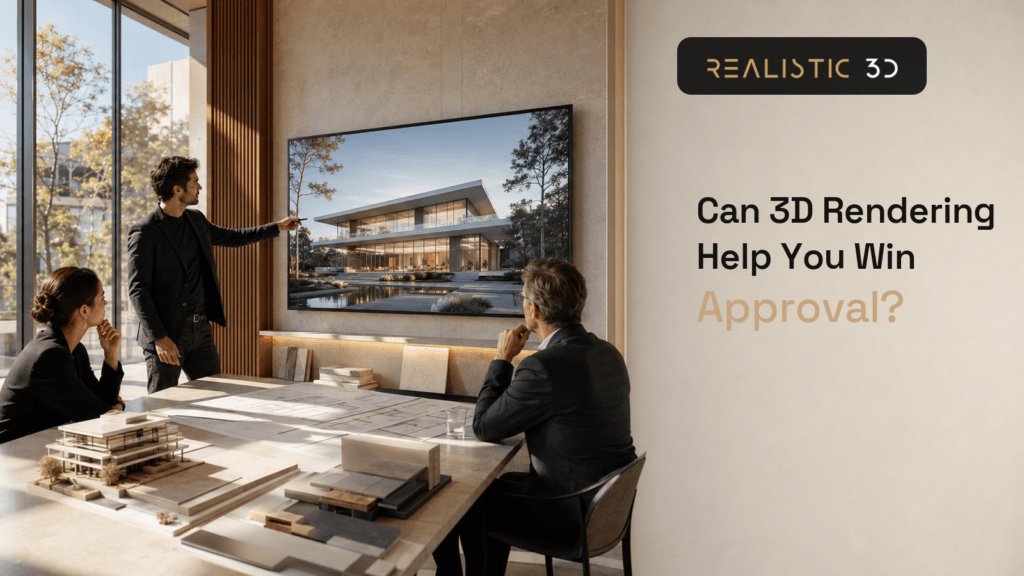
Most planning applications are not refused because the drawings are unattractive. They run into difficulty because a case officer, committee member, or neighbour cannot see the proposal’s real impact clearly enough.
3D rendering for planning permission does not change the policy tests. It makes the scheme easier to judge against them.
This UK guide explains when you need a planning visual, what verified views and AVRs mean, and how to brief a studio without commissioning the wrong type of image. For the general process behind architectural CGI, see our architectural 3D rendering service.
Does 3D rendering for planning permission help you win approval?
Yes, when the visual answers a genuine planning question clearly and accurately. No, when it is a flattering marketing image that hides the issue an authority needs to assess.
Planning permission depends on policy, design quality, consultation, technical studies, and the evidence supplied with the application. A render cannot compensate for a scheme that conflicts with those requirements.
What it can do is reduce uncertainty. It can show a building’s massing, material choices, relationship to its neighbours, and effect on the streetscape in a form that non-specialists can understand quickly.
That matters because planning decisions involve more than one reader. Officers, committee members, consultees, and local residents may all need to interpret the proposal. In England, 88% of district-level planning decisions were granted between April and June 2025, but each decision still depended on the merits of the application and the evidence submitted.
A good planning render does not try to sell the project. It makes its impact easier to assess fairly.
What is a verified view or accurate visual representation?
An Accurate Visual Representation, or AVR, is a visual built from a defined real-world viewpoint, camera information, and reliable project data. A verified view is the more rigorous version, designed to show a proposal accurately within a real photograph of the site.
The key difference is accountability. A normal CGI can choose a dramatic angle, ideal weather, or an uncluttered setting. A verified planning view starts with the viewpoint that best represents the issue under review, then matches the camera and proposal to it.
| AVR level | What it shows | When it can be useful |
|---|---|---|
| AVR0 | The proposal’s location and overall size | Early scoping or pre-application discussion |
| AVR1 | Its degree of visibility | Screening potential views and impact |
| AVR2 | Its architectural form and massing | Consultation, design review, or committee material |
| AVR3 | Materials, colour, lighting, and a photorealistic appearance | Sensitive sites, final assessment, or public-facing consultation |
The levels build on each other. AVR3 includes the basic location, visibility, and form information from the earlier levels, then adds a more realistic representation of the scheme.
The classifications are set out in Appendix C of the London View Management Framework. The framework is specific to London’s protected views, but similar verified-view methods are used across the UK where a proposal’s visual impact needs careful assessment.
What detail do planners expect from a planning visual?
The expected level of detail depends on site sensitivity, project scale, and what the authority needs to assess. A minor extension in an ordinary setting may need no verified view, while a tall building near heritage assets may need several.
Start by checking the local validation list. It tells you what the planning authority expects with an application and may specify drawings, photomontages, townscape studies, daylight assessments, or a digital model.
Use this as a practical guide when deciding what to commission.
| Project condition | Visual approach to consider | Supporting material often needed |
|---|---|---|
| Small householder project in a non-sensitive area | Simple CGI or no render | Scaled plans and elevations |
| Conservation area | AVR2 or AVR3 | Townscape or heritage assessment |
| Listed building or important setting | AVR3 from agreed viewpoints | Heritage impact assessment |
| Tall building or highly visible proposal | Multiple verified views | Zone of Theoretical Visibility and townscape assessment |
| Major residential or mixed-use scheme | AVR2 or AVR3 | Daylight, sunlight, streetscape, and landscape information |
| Protected London view | Verified AVR from required viewpoint | LVMF-compliant assessment |
The biggest mistake is assuming detail always means photorealism. Sometimes a clear massing image is more useful than a polished render because it lets the viewer focus on height, form, and visibility.
For tall buildings and sensitive heritage settings, viewpoints must be genuine rather than chosen to make the scheme look better. Historic England’s tall-building guidance is particularly useful when deciding where to test a proposal and how to assess its visual effect.
Can renders show daylight, sunlight, and overshadowing context?
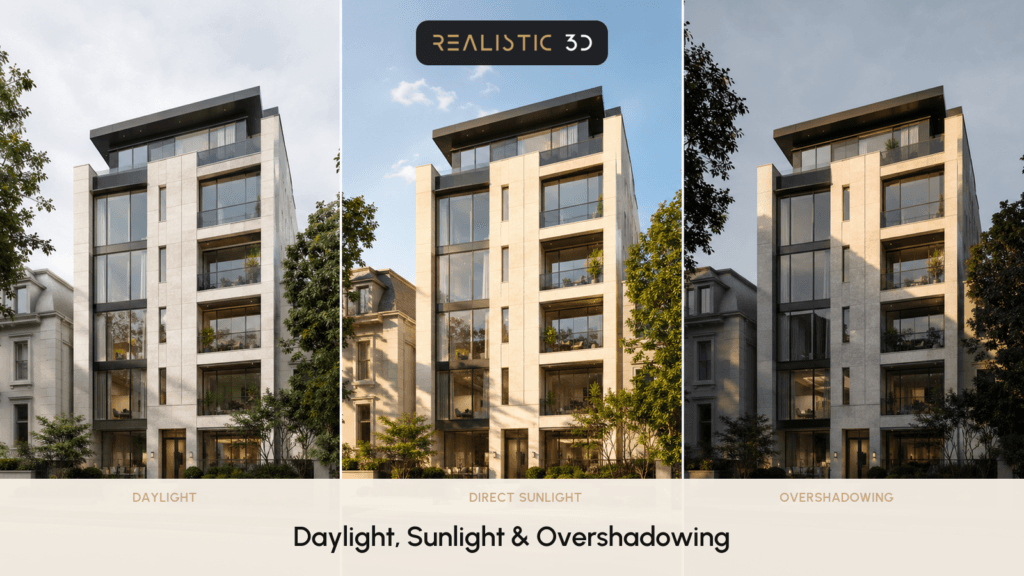
Renders can illustrate where shadows fall and how a scheme changes a space. They do not replace a formal daylight and sunlight assessment when one is required.
A well-built shadow visual can help a planning team understand the issue quickly. It may show the effect on a garden, neighbouring windows, public space, or a proposed courtyard at specific times of day and year.
However, the technical assessment sits behind the image. In the UK, the current reference is BRE BR 209, which covers site layout, daylight, sunlight, and overshadowing.
One useful benchmark is that at least half of an amenity area should receive two hours of sunlight on 21 March. But this is not a shortcut for approving or refusing a scheme. Site conditions, layout, design quality, local policy, and the type of space all matter.
It is also important not to confuse planning daylight work with Rights of Light. A daylight and sunlight assessment supports planning decisions. Rights of Light is a separate property-law matter that may need specialist legal advice.
How do planning visuals differ from marketing renders?
Planning visuals are made for accuracy and accountability. Marketing renders are made to create desire, attention, and a strong first impression.
Both can be high quality. They simply have different jobs.
| Planning visual | Marketing render |
|---|---|
| Uses a justified or agreed viewpoint | Uses the most attractive viewpoint |
| Represents the relevant surroundings honestly | Can simplify or improve the setting |
| May need camera matching and survey control | Can use a more cinematic composition |
| Supports an application and technical evidence | Supports sales, leasing, funding, or promotion |
| Shows what must be assessed | Shows what the audience should feel |
At Realistic3D, our first question on a planning brief is not how dramatic the image should look. It is what the authority needs to verify.
That does not mean planning visuals must feel lifeless. Good composition, clean materials, readable lighting, and careful landscaping still matter. They simply cannot change the facts the viewer is meant to assess.
For examples of how clear architectural visuals can communicate design intent across different project types, browse our recent projects.
What mistakes can make planning visuals less useful?
The most damaging mistake is choosing a flattering view instead of a meaningful one. If the render avoids the sensitive relationship between a proposal and its surroundings, it creates more questions than it answers.
Other common mistakes include:
- Using a marketing image when a verified view is required
- Showing generic or inaccurate neighbouring buildings
- Adding lush planting that hides the real scale of the proposal
- Using the wrong camera height or field of view
- Ignoring the local validation list until late in the application
- Treating a daylight image as a substitute for a technical daylight assessment
- Producing an AVR3 image when the real issue is massing, visibility, or viewpoint selection
The solution is simple. Agree the visual purpose before production begins, then make sure the method matches that purpose.
How should you brief 3D rendering for planning permission?
Brief 3D rendering for planning permission as an evidence task, not as a request for attractive pictures. Tell the visualisation team what the authority must understand and which parts of the project are under the most scrutiny.
A strong brief should include:
- Current plans, elevations, sections, and site layout
- A 3D model where available
- Site photographs and survey information
- The planning application type and local authority
- Any relevant validation-list requirements
- Heritage, daylight, landscape, or townscape reports
- The proposed viewpoints and any agreed camera information
- Material references for cladding, glazing, brick, roofing, and landscape elements
- The deadline for submission, consultation, or committee review
At Realistic3D, we agree the visual purpose and level of accuracy before detailed modelling begins. This keeps the image aligned with the application rather than turning a planning task into a marketing exercise.
What else do clients ask about planning visuals?
These are the questions that usually arise once a project team starts preparing its application. The right answer depends on the local authority and site, so treat them as a practical starting point rather than a universal rule.
Do I need a verified view for a small extension?
Usually not. A straightforward householder application in a non-sensitive setting may be supported by drawings, elevations, and a simple visual if one is helpful.
A verified view becomes more likely when the proposal affects a conservation area, listed building, protected view, sensitive streetscape, or heavily constrained site.
Does the London View Management Framework apply outside London?
No. The LVMF is London policy for designated views within the capital.
Its approach to accurate visual representation is influential, but councils outside London set their own validation requirements.
Always check the relevant local authority guidance.
Is a daylight and sunlight study the same as a Rights of Light assessment?
No. A daylight and sunlight study is part of planning evidence and considers the effect of a proposal on daylight, sunlight, and overshadowing.
Rights of Light is a separate private property issue. Planning permission does not automatically resolve it
What documents should I send to a visualisation studio?
Send plans, elevations, sections, site photographs, material references, and any survey or 3D-model files you have. Include planning reports and local authority requirements where they affect the visual work.
It is also useful to explain who will view the images and what they need to understand. A committee image, heritage visual, and sales image may all use the same building model but require different outputs.
Can a planning render replace architectural drawings?
No. Renders support drawings by making the proposal easier to understand.
Planning authorities still need the plans, elevations, sections, and technical documents required for the application. A render should clarify those documents, not replace them.
Can planning visuals show proposed materials?
Yes. Materials such as brick, cladding, glazing, roofing, paving, and planting can be shown clearly in an AVR3 or other detailed planning visual.
The important point is that the materials shown should match the submitted design information. Do not use a render to introduce finishes that are not part of the application.
How much does 3D rendering for planning permission cost?
3D rendering for planning permission costs depend on the number of viewpoints, existing model quality, survey requirements, site complexity, and whether the job needs a verified-view method. A simple planning CGI and a multi-view AVR package are very different scopes of work.
The clearest way to price the work is to share the planning brief, drawings, site information, and deadlines. That allows the studio to recommend the right level of visual evidence instead of selling unnecessary images.
Can an animation help with a planning application?
Yes, an animation can help people understand a large or complex proposal, especially during consultation or stakeholder presentations. It should support the formal evidence rather than replace required verified still views.
Where movement would help explain arrival, scale, public realm, or a phased development, our architectural 3D animation service can be planned alongside the still-image package.
What is the right visual approach for your planning application?
Start with the planning question, not the image style. If the authority needs to judge visibility, choose justified viewpoints. If it needs to understand form, use clear massing. If materials and townscape impact matter, consider a detailed AVR or verified view.
The right visual makes the proposal easier to assess without overstating what the design can deliver.
If you need help defining the evidence your scheme requires, contact our visualisation team with your drawings, site information, and planning brief.
